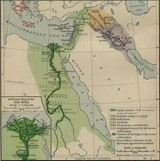
Egypt is located in the north western region of Africa, with the Mediterranean Sea to the north and a mountain range to its south. The climate is arid and dry, as the Great Sahara crosses the country. The Nile is fed by the White Nile and the Blue Nile- which is why it never dries out. The river used to flood annually through the melting snow in the mountains. Less than 10% of Egypt is settled or used in some way or the other, but around 90% of the area is made up of the Libyan desert, Saharan desert, and Arabian desert.
Egyptian Geography
According to Egyptian Geography, Egypt can also be divided into Upper and Lower Egypt. To the north was Lower Egypt where the Nile stretched out to form the Nile delta. To the south was the Upper Egypt stretching till Syene. The terminology of “Upper” and “Lower” derived from the flow of the Nile from the East African highlands to the Mediterranean Sea.
For the Ancient Egyptians, and was divided into two parts – “the Red land” and “the Blank land”. The Black Land was the fertile plains of the Nile River where the black silt was deposited every year after the Nile floods, rich in alluvium, which was used for supporting the entire population with Lucious vegetation and abundant game.
The Red land
The Red land was the barren desert which protected Egypt from marauding enemies. this dessert was also rich in precious and semi precious gems and provided a rich natural resource for the whole country.
In terms of agriculture, the Egyptians grew many crops like wheat, barley, legumes, lettuce, onions, Emmer, leeks, grapes, melons, and gourds. They also grew trees like date palms and eucalyptus, along with lilies, lotuses, papyrus, etc.
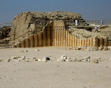
Archaeological finds corroborate to the bringing together of the two parts of Egypt by the historical king Narmer, the most influential being the Narmer Pallete. He could be associated with the legendary King Menos, referred to in ancient texts as bringing the “two lands under control”. Even though the two parts were united to form one coherent country in about 3000BCE, each maintained its own coherent culture. The people spoke different dialects and were culturally very different too. Some of these differences still exist in the modern times.
